Archive for May 2021
Sapphire Coast NSW – Plan your next holiday
Sydney Australia is a postcard city with stunning architecture and beaches attracting millions of visitors each year. It has been voted in the top 10 cities in the world and for most people it has either been ticked off their bucket list or is soon to be.
With the NSW coastline stretching 1400km, there is a lot of untouched beauty to explore. So if you are planning a holiday and want your own secret paradise then continue reading, because this article will be concentrated on the south coast of NSW.
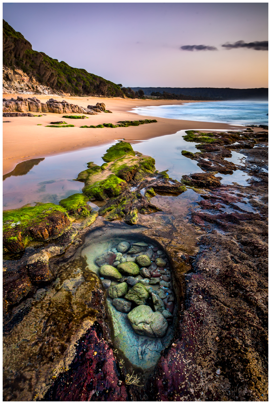
Sunrise at Aslings beach, Eden.
Click to enlarge
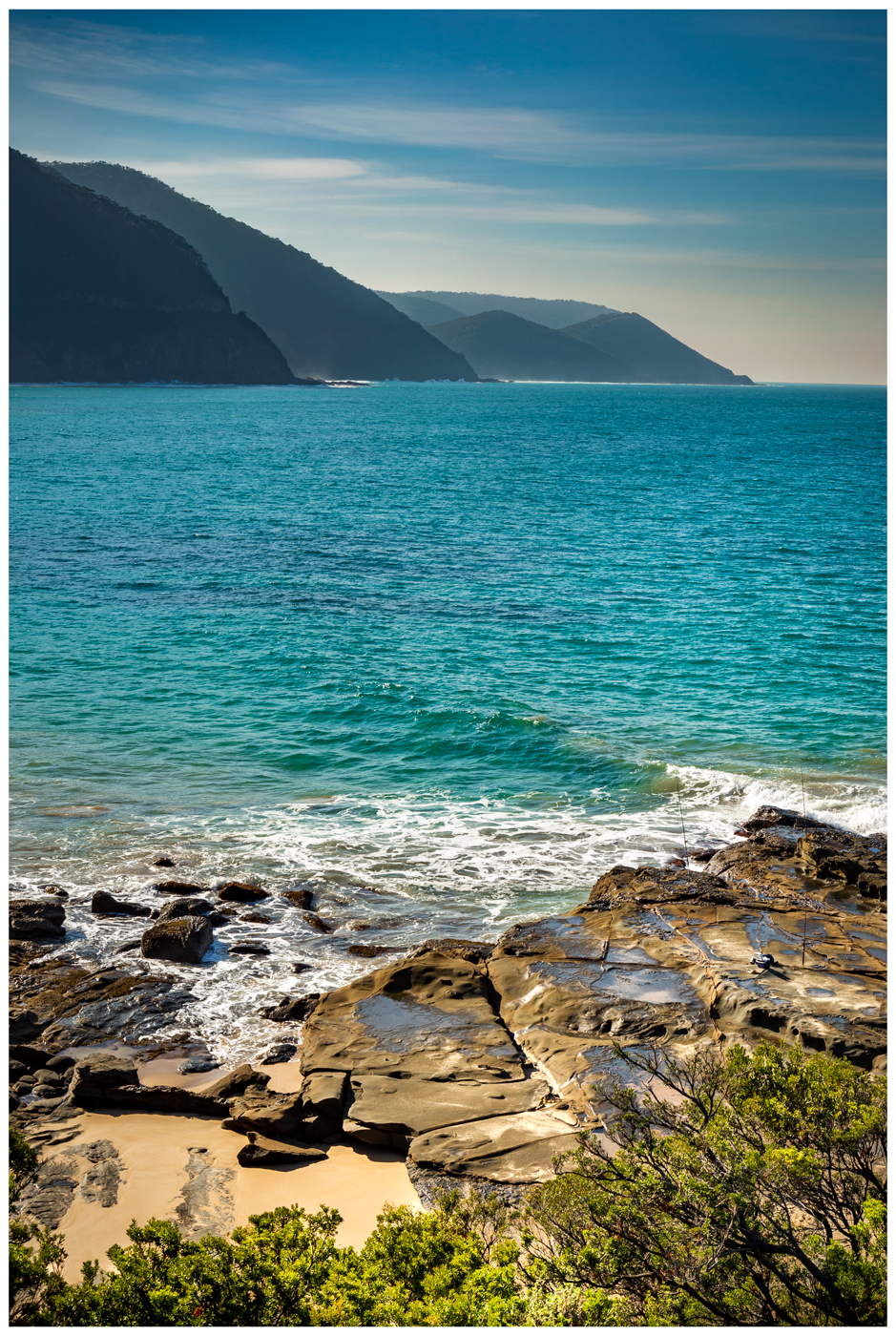
The south coast is known as the Bega Valley Shire, however is also referred to as the Sapphire Coast for tourism purposes. It starts in the small town of Eden which is famous for its whaleing history. It is home to one of the deepest harbours in the world and is thriving in marine biodiversity. This makes it a popular area for scuba divers chasing mussels, oysters, squid and abelone.
During winter many species of whale can be seen migrating and feeding as they swim past Twofold bay.
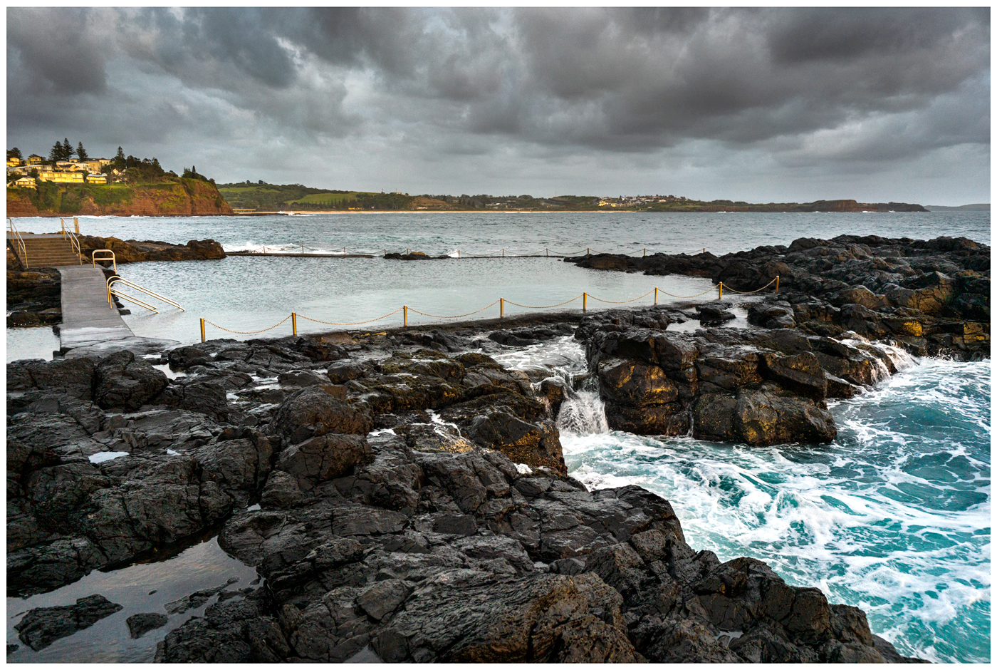
Aslings beach is a popular spot for a swim with an ocean pool, outdoor showers and picnic tables.
Experience the freshest seafood straight off the boat from the Eden wharf at snug cove.
Sunrise at Aslings beach, Eden.
North of Eden is Merimbula, a small town with a relaxed vibe. Take a drive up to Short Point headland which offers panoramic views out to the South Pacific ocean.
The contrast of white sand and vivid blues are stunning from any angle, with endless lakes and estuaries for stand up paddle boarding, kayaking and snorkeling there are plenty of reasons to visit.
For animal lovers, Head inland just 10km to Potoroo Palace wildlife park and encounter Australia's native animals up close.
Tathra
The next stop is Tathra, a coastal town well known for locally harvested oysters from the pristine Nelson and Wapengo Lakes within Mimosa Rocks National Park. A large portion of the surrounding land area consists of national park and dairy farms particularly home to Bega Cheese which is an Aussie staple that is exported around the world.
For an adventure, take a bike ride through the Bournda national park which has over 50km of mountain bike trails that cater for beginner to experienced riders.
Offshore is the SS Empire Gladstone ship which became wrecked in 1950 on a voyage from South Australia to Newcastle. Its a popular dive spot during winter when the summer winds have settled and visibility is good.
Nearby is Bermagui, a small town with a population of 1600 people including a strip of shops and cafes. 'Bermi' as its often referred to is only 12 miles from the oceans continental shelf which has made it an attraction for big game fisherman over the generations. Famous for its marlin, and variety of tuna such as yellowfin and albacore.
For those looking to cool off, try the blue pool as it is a hidden gem well worth a visit. The incoming tide refills the pool with fresh ocean water creating a perfect environment for a relaxed swim.
The best time to visit the pool is early morning from 10am as it gets quite busy. If parking is full, try Cuttagee beach as another great option.

Blue pool, Bermagui.
5 minutes drive north is Wallaga lake, here there are several rock formations along the beach which are popular for photographers and artists. Horse head rock and Camel rock are the two most commonly visited. At low tide there are an endless array of shells and small rock pools which create an interesting foreground in a photo.
Access to the rocks can be done at low tide via some rock scrambling or alternatively there is a path on top of the headland with a viewing platform. Both options offer a fantastic view of the rocks.
Horse head rock.
Note: Hiking to horse head via rocks at low tide is quite dangerous as there are several bays to cross over in accordance with the tide, so make sure to wear supportive footwear and check the tide charts prior to hiking.
Continuing north 4 hours along the A1 highway: Passing through Mogo Forest, Batemans Bay and Jervis Bay which are popular holiday destinations you will then arrive at Kiama.
On arrival you are greeted with sweeping views of the hinterland and ocean, a region historically known for its red cedar trees which were used by early settlers to build ships and furniture.
The township is nestled amongst Terralong St with stunning 18th century buildings along with modern conveniences of today including shops and restaurants.
Close by you can walk amongst tall Norfolk trees to visit the blowhole and lighthouse that offer coastal walks to neighboring beaches.
Indulge in freshly caught seafood at the harbour market just next to the ocean pool or enjoy live music at Hindmarsh park all within walking distance of Terralong street.
Ocean Pool, Kiama.
Spending the night? Stay in comfort at one of many apartments, holiday parks and B&B's available.
For an outdoor adventure visit the Cathedral rocks and explore the sea caves at low tide which is a spectacular spot to watch the sunset.
Kiama offers a perfect mix of experiences from the rainforests, RSL clubs, day spas and wineries. Making the region well worth a visit.

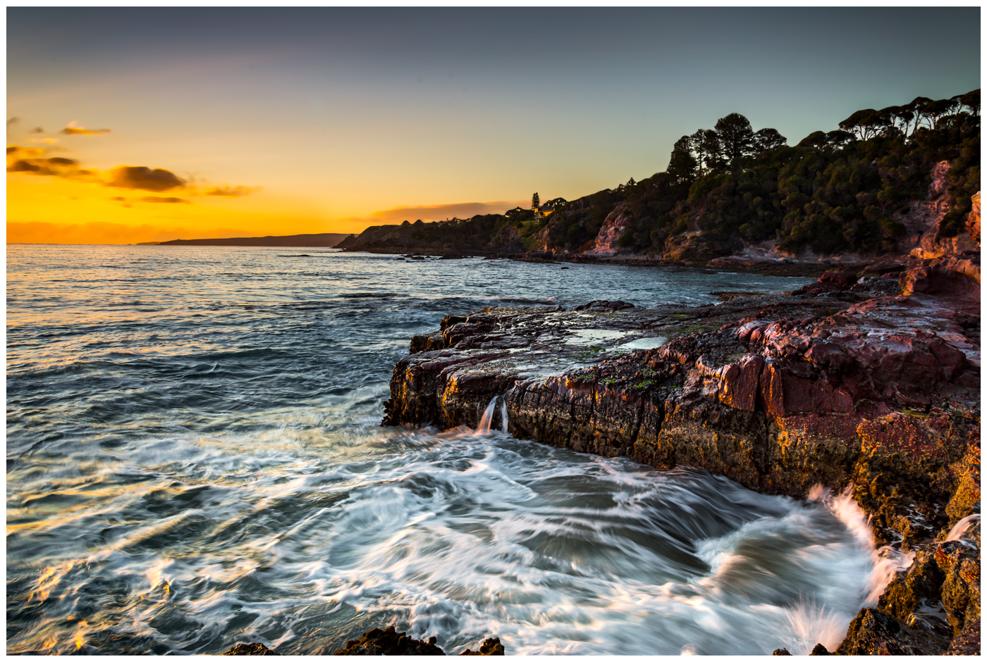
Sunrise at Cathedral rock, Kiama
Deeply embedded in the history of Kiama are the stories of Bombo, the historic quarry where basalt columns line the ocean shore. This was a large mining site of steel between 1880-1900, broken up by steam powered crushing machines and loaded onto ships.
Hundreds of tons a week were being sent to Sydney known as the Stone Fleet.
Kiama’s basalt (volcanic rock) was suitable for road, rail and tramway construction and was a critical part in the transport boom in Sydney.
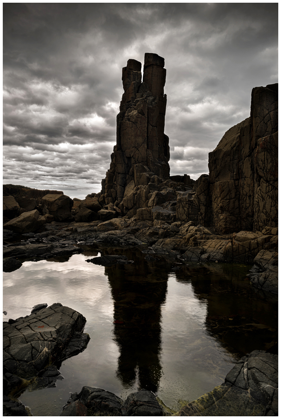
Bombo quarry
From here continue north along the Grand Pacific Drive, stretching 140km passing through Woolongong and Coal Cliff, home to the infamous Sea Cliff Bridge.
Close by is Bundeena and Maianbar which are popular little villages to visit situated along Port Hacking.
The scenic drive continues through to the Royal National Park and into Sydney.
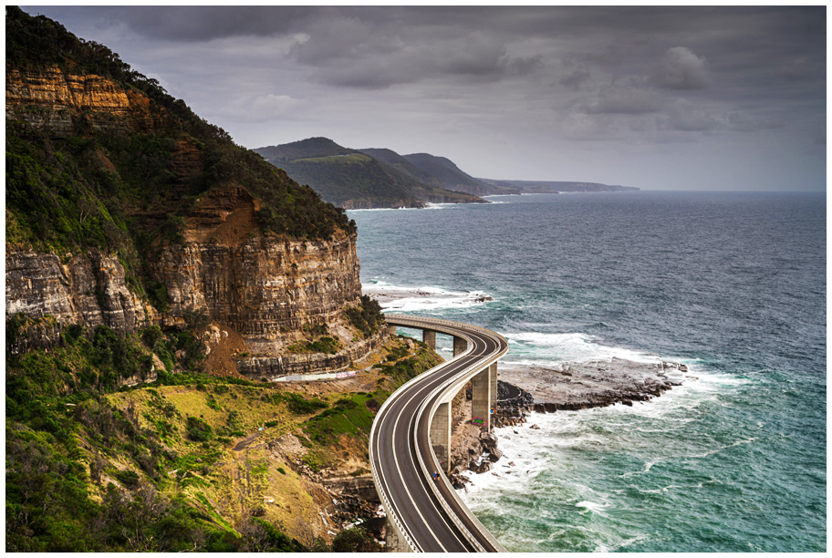
Sea bridge, Coalcliff.
Summary: The NSW south coast is packed full of opportunities, from the rainforest to the sea, there are endless natural wonders that create the perfect holiday for all ages with the best months to visit between November and May.
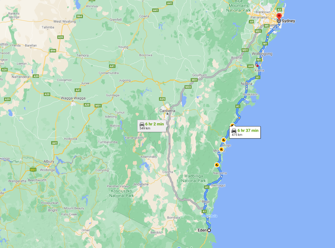
Getting There: Starting in Eden, follow the Princes Highway/A1 north.
Additional Sapphire Coast Photos:
")

")
")
")
")
")

")
Lamington National Park – Top 5 Things To Do
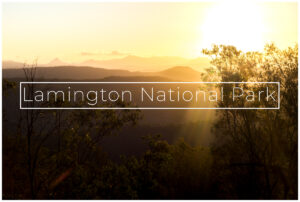
Nestled away in the Gold Coast hinterland is Lamington National Park, a cornucopia of natural wonders and activities.
The park is classified as world heritage rainforest with a long history that dates back
to the Paleozoic era more than 225 million years ago when South America, Australia and Antarctica were joined.
Australia finally broke away from Antarctica and began to move northwards 70 million years ago.
Following this continental shift, volcanic activity took place across Australia and particularly the scenic rim, leaving behind beautiful gorges, waterfalls and a large diversity of flora and fauna unlike anything else in the world.
Welcome to Lamington National Park, it really is as tasty as it sounds.
Here are the top 5 things to see and do when visiting:
1. Tree top walk
2. Birdlife
3. Picnic rock
4. Elabana Falls
5. Scenic views

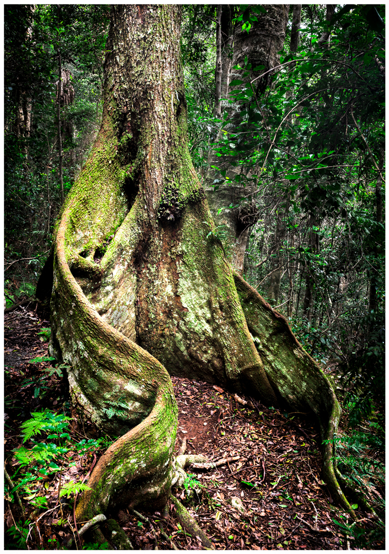
The tree top walk is situated along the Booyong boardwalk (800m return) nearby the O'reillys guest house.
At 15m elevation it gives you a perfect vantage point to spot birdlife and gets you up close with the ancient Booyong tree, a native species to QLD that grows up to 45m tall due to its deep root system.
The tree top walk consists of multiple suspension bridges, zigzagging its way through the rainforest.
The walk is free and bird feeding costs a few dollars.
 Booyong Tree
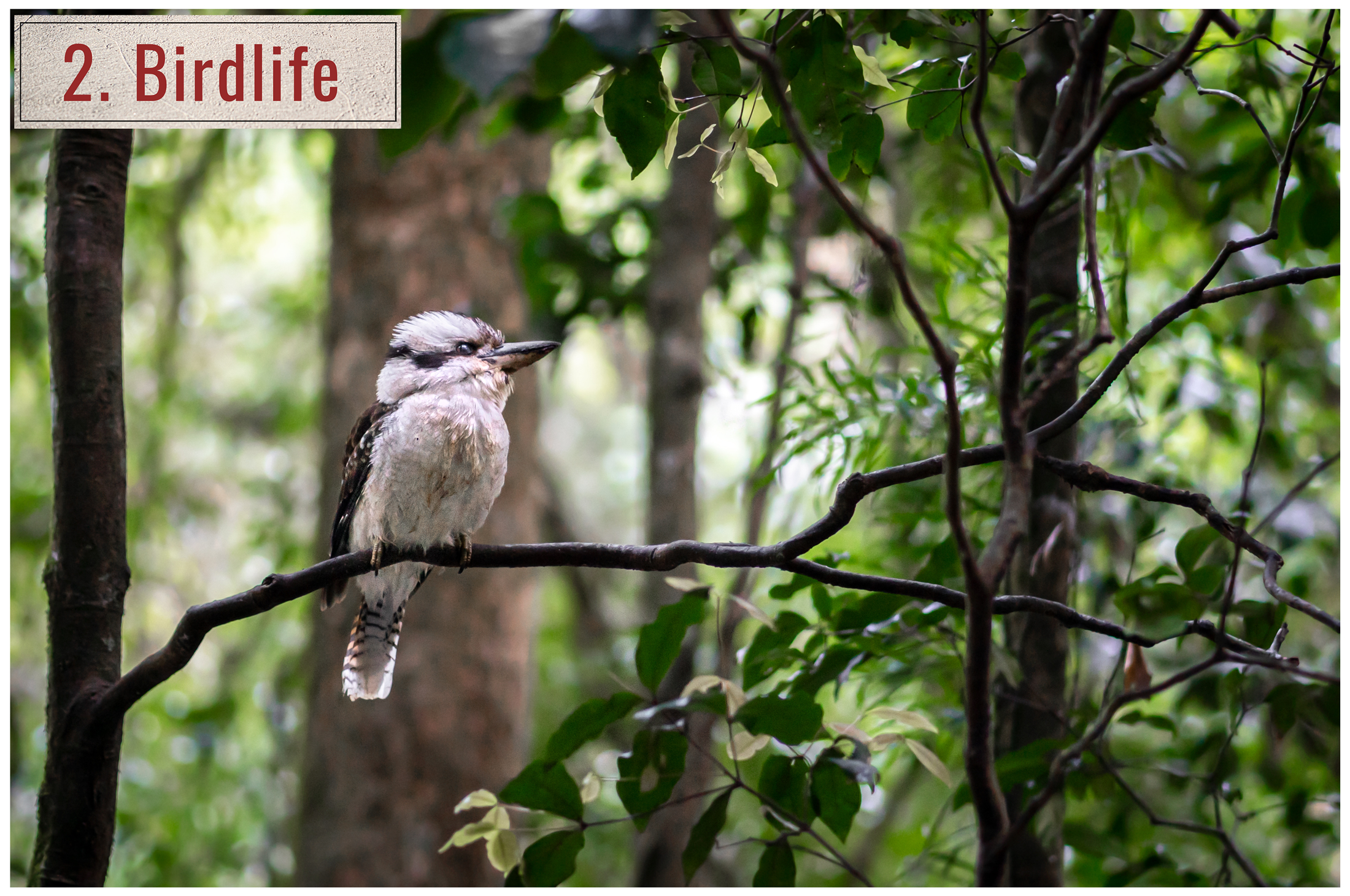
Over the course of millennia, the dense forest canopy has created refuge for an array of birds such as parrots, rosella's, bower's, lewin’s honeyeater, eastern spinebills, fairy-wrens, kookaburras and the spectacular alberts lyrebird.
Along with 160 other species of subtropical birds which attract avid bird watchers and photographers from all over the world.
These feathered friends are so used to human interaction that they fly right into your hand to be fed.
O'reillys also offer their birds of prey show, each day their resident eagles and owls fly through a seated audience showing off their majestic colors.
bookings for this show are required.

Picnic rock is 3.3km from O'reillys carpark located on the Box Forest Circuit, at the top of Elabana falls.
It has a series of large flat boulders making it the perfect spot to take a break and have lunch
while soaking in the peaceful sounds of the cascade.
The Lamington waterways are home to a unique and endangered species of Spiny crayfish which both swims and walks on land.
Keep a look out for their distinctive blue color.
Following Picnic Rock be sure to continue on 400m to Elabana Falls.
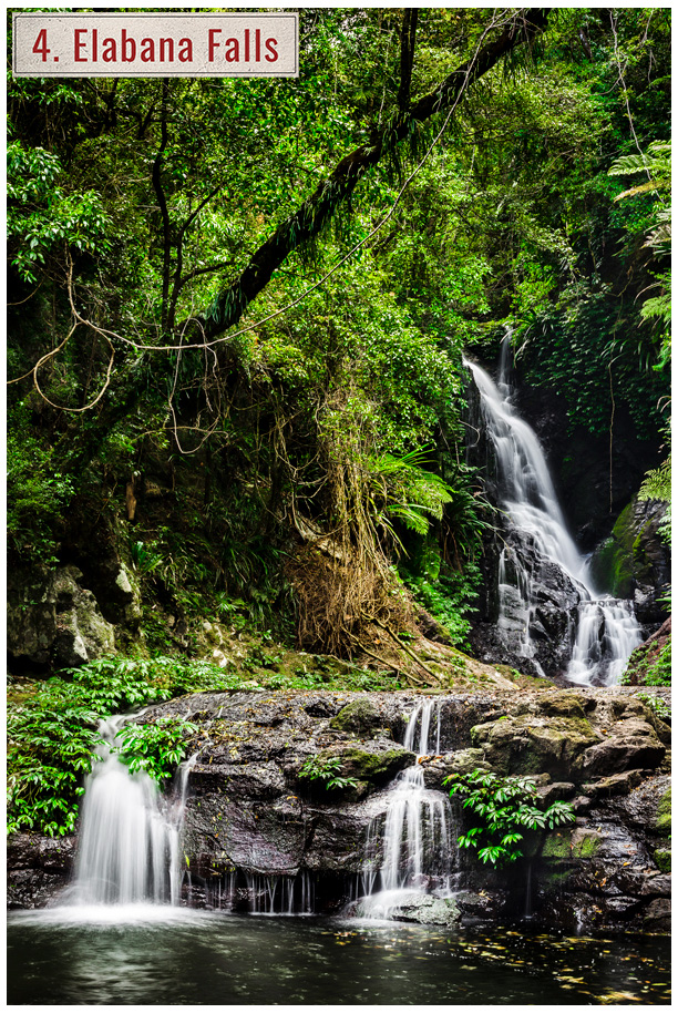
The path branches off the main border track 1.7 km from the carpark and is a further 2km from the signpost.
Winding its way down the rainforest through ancient Brush Box and stunning Antarctic Beech trees.
The track is classed as grade 4 and can be slippery after rain so its advised to be well prepared with food,
water and correct clothing. Its also highly advised to check the QLD government website for any updates
or closures due to track maintenance prior to starting your hike.
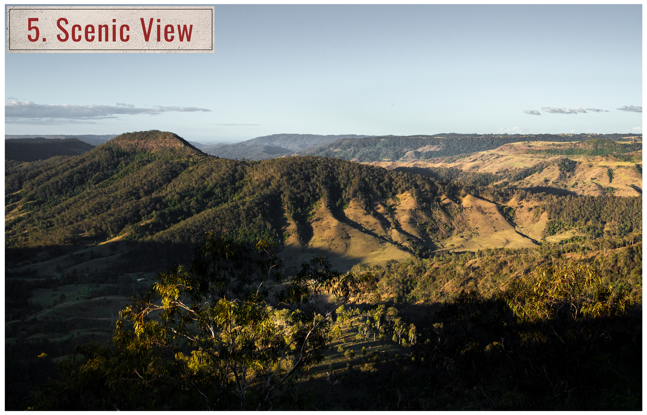
The drive up to Lamington offers panoramic views west out to the Scenic Rim and Mcpherson range.
With clear weather conditions Mt Lindsay and Mt Barney can be seen in the distance.
The national park covers more then 20,000 hectares, which means there is plenty to explore.
Lamington is 900m above sea level, so temperatures can be much cooler then surrounding low lying areas.
The weather can change very fast at this altitude so always take appropriate clothing.
 Mt Barney
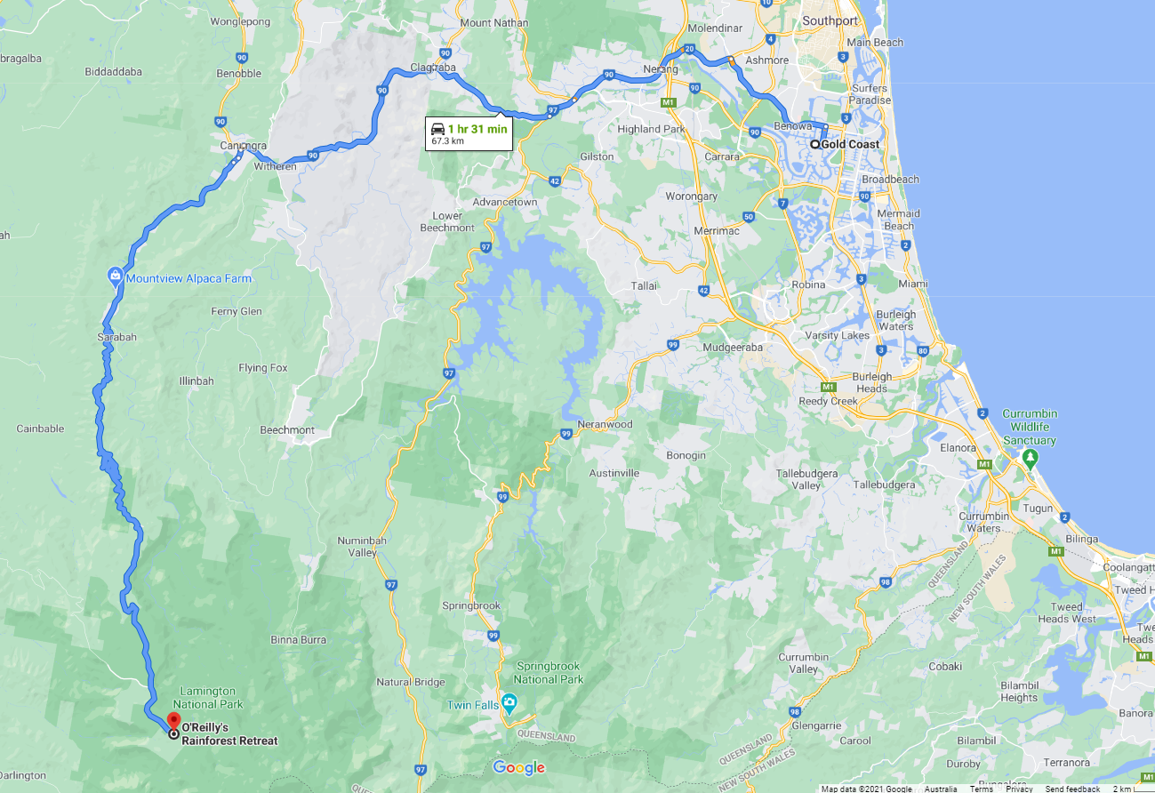
Getting there: Follow Lamington National Park Rd via Canungra until reaching O'reilly's guest house and carpark.
Wilsons Promontory Victoria.
Is the Prom Victoria's best kept secret?
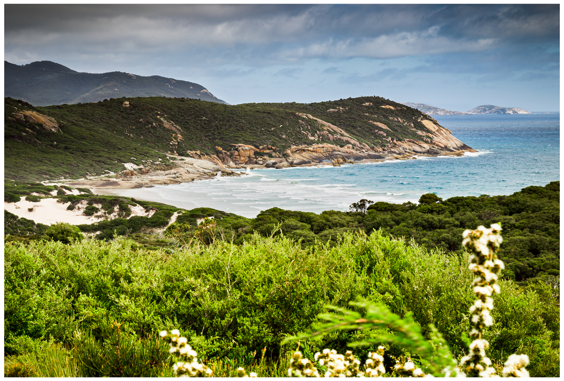
Wilsons Promontory National park is situated 250km south east from Melbourne in the rural Victorian region of Gippsland. It is the southern most tip of mainland Australia offering white sandy beaches, mountains, estuaries and off shore islands.
The entrance to the Prom begins at the northern section of the park. The terrain is flat and open bushland, perfectly suited for kangaroos, emus and the popular local, the wombat.
Kangaroos can be seen in large groups grazing by the side of the road.
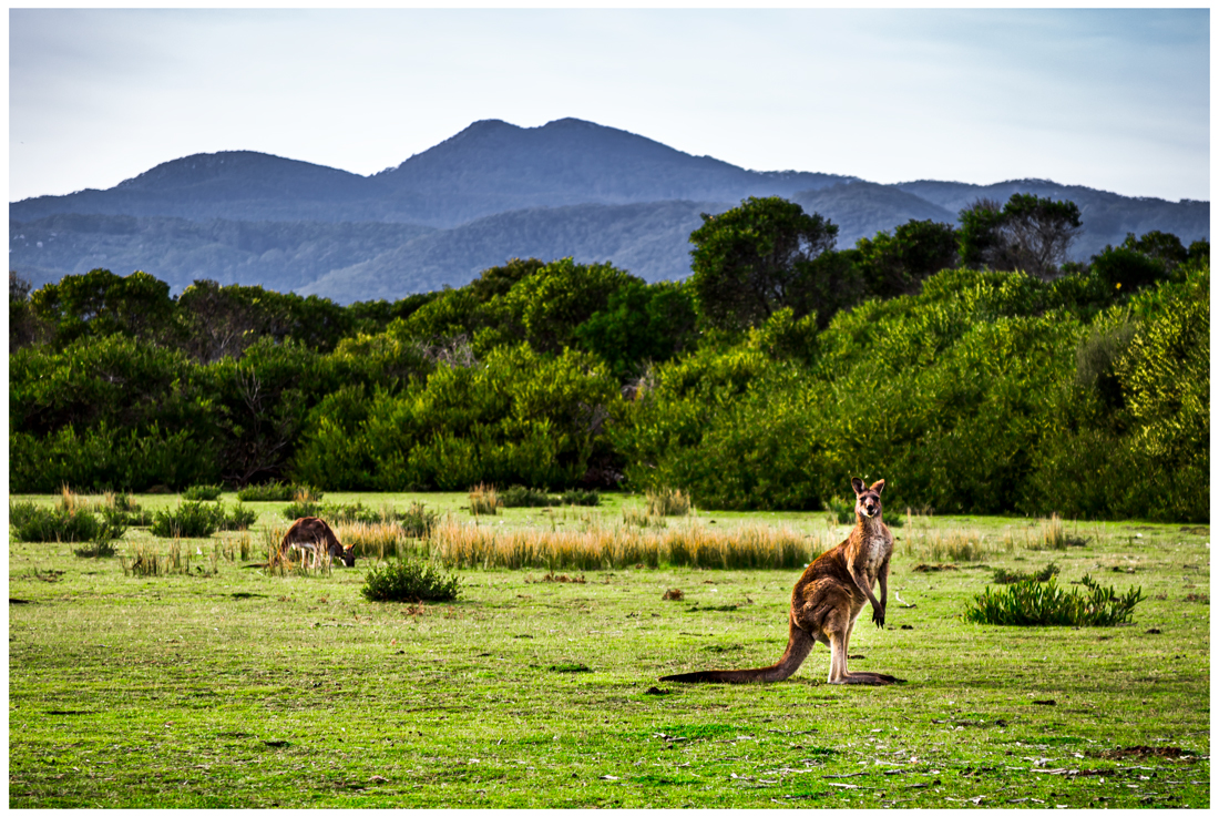
Kangaroo, Prom entrance
(Click to enlarge)
Close by is the Big Drift. A remote and expansive sand dune that stretches for kilometers, the dunes landscape is always changing as its shaped by the wind.
Continuing on the road starts to bend as it nears the ocean, offering the first glimpse of the coast. Granite boulders dominate the landscape and can be seen lining the turquoise water and nearby islands.
The only settlement is Tidal River which acts as a base within the park. There are camp grounds, cabins, hot showers and laundry facilities. Along with an information centre and a general store that sells a small selection of groceries.
Leonard Bay
There are plenty of picnic tables in this area tucked away in private alcoves that protect from the southerly wind, Its a great environment to experience the native wildlife up close.
Wildlife isn't the only thing The Prom attracts in abundance, bush walkers from all over the world come to experience the untouched beauty, which stretches over 130kms.
The park is 48,000 hectares in size and is the largest coastal wilderness area in Victoria, that being said there are plenty of hiking trails which cover different regions of the park and can be split up into over night hikes.
These include Sealers Cove, Refuge Cove, Little Waterloo Bay and the Lightstation to name a few.
There is also plenty of short day walks to enjoy such as Pillar Point and Little Oberon Bay along with the 3 most prominent beaches Whisky bay, Picnic bay and Squeaky beach.
Squeaky beach has fittingly earned its name by the fine quartz sand that squeaks when walked on. Once you have squeaked your way to the shoreline experience the grandeur of enormous boulders covered in a distinctive orange color. These colors are caused by Lichens which are a combination of algae and fungus that live together symbiotically.
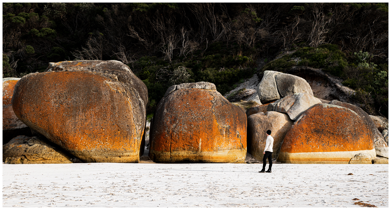
Granite boulders, Squeaky beach
This cluster of beaches can be accessed via a coastal walk or their own carparks. Due to the peninsula's westerly aspect it offers the rare opportunity to see the sun set over the ocean from the east coast of Australia.
Close by Norman beach is a great way to get acquainted with the natural surroundings, only a stones throw from Tidal River. White sand and shallow pools form around granite rocks showcasing the quintessential promontory landscape.
Tidal River camp ground is located here at Norman beach and offers expansive spaces for outdoor activities among the 480 camp sites.
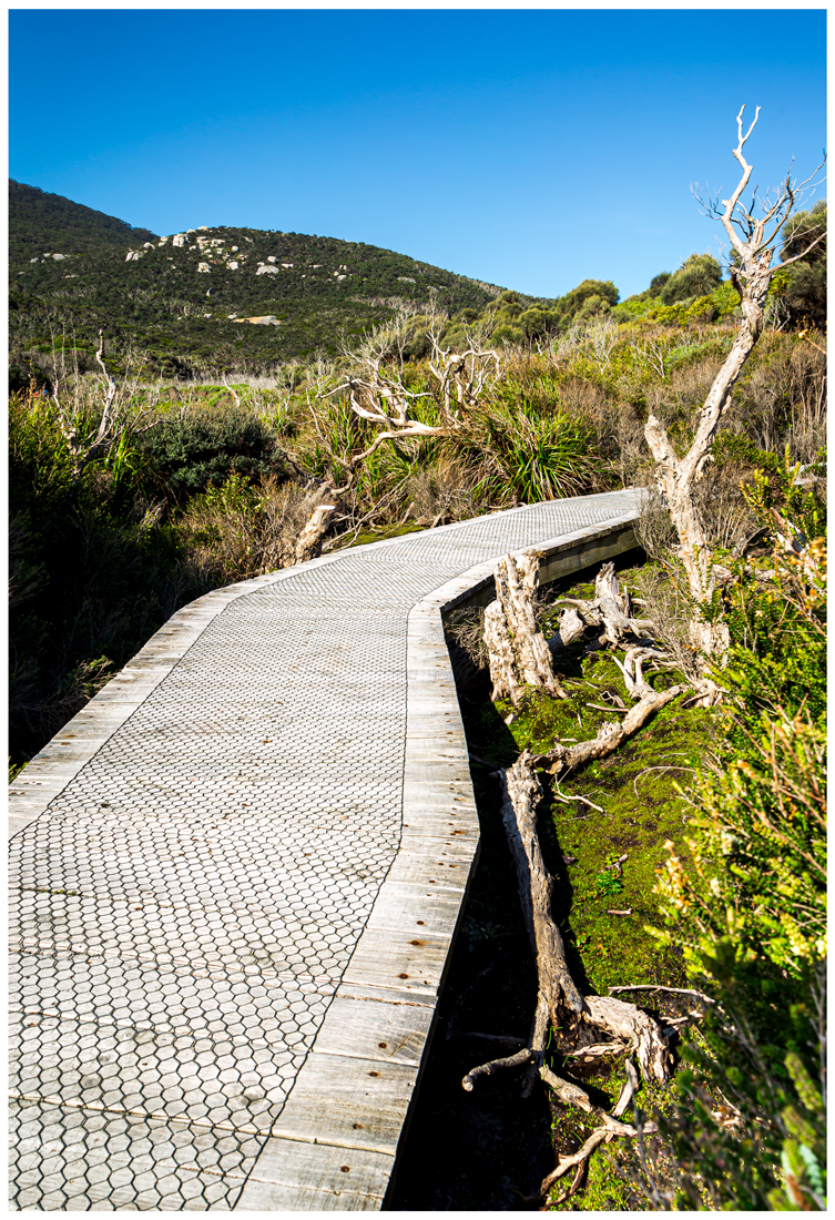
Boardwalk to Picnic Bay
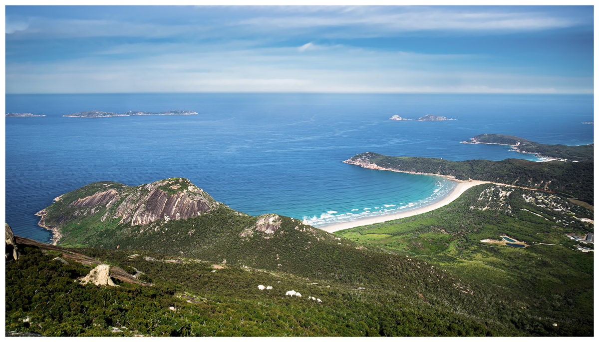
Upon driving into the park Mount Oberon can be seen standing 558m high, The summit offers incredible 360 degree views over the park.
The Mt Oberon hike starts at Telegraph Saddle carpark and is a moderate incline for 3.4km along a fire trail.
During the hike its common to encounter wallabies, especially at dawn and dusk. Near reaching the top there is a short rock scramble to the summit.
It is considered one of the best vantage points in the park offering views out to nearby islands and Norman Point.
Telegraph Saddle has a small carpark which in summer is closed, instead a free shuttle bus runs there from Tidal River which helps minimize congestion during summer.
Mt Oberon summit, looking over Norman point and Tidal River camp.
The Lightstation is a popular attraction with a small number of cottages to stay the night in comfort. The walk is 20km each way and forms part of the Southern Circuit, winding its way through the lush rainforest canopy. Walk along side coastal Banksia plants and a wide range of flora to the most remote and expansive beaches in the park. It is recommended to allow 3 days to complete the Southern Circuit.
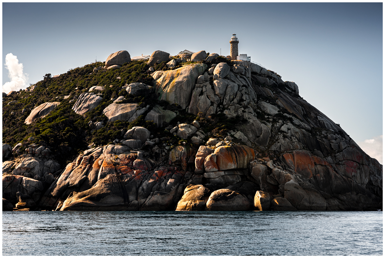
Lightstation, built in 1859.
A new edition to the park is an ecotour boat cruise which is a great way to explore the Prom. Visit remote islands such as Skull Rock, Kanowna Island and other hidden gems along the coastline for over 2.5 hrs. The cruise will get you up close to nesting sea eagles and whales during migrating season. Kanowna Island is home to the worlds third largest seal colony.
These pristine waters are home to an array of colorful invertebrate life such as soft corals, yellow zoanthids and different variety's of sea stars among other marine life such as crab, crayfish and the blue ringed octopus.

Skull rock.
Summary: The Wilsons Prom is a unique wilderness getaway offering activities for all ages and fitness levels. Experience the untouched beauty of remote beaches and wildlife while staying in comfort at Tidal River.
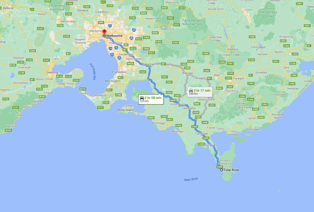
Getting there: From Melbourne follow the Monash Freeway until reaching Trafalgar then turn off onto the C469 and follow the signs heading toward Fish Creek and Yanakie which are the last towns before reaching the Wilsons Promontory.
Additional Prom Photos:
fergusgreenimagery")
fergusgreenimagery")
fergusgreenimagery")
")
")
")
")
")
")
")
Great Ocean Road VIC – Road trip and Attractions
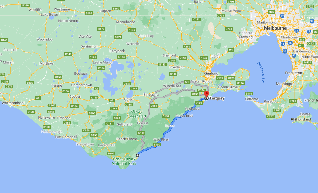
Melbourne Australia is renowned for its wide variety of attractions. It offers everything from hospitality, fashion, art and much more, there really is something for everyone. Adding to the list is visiting the Great Ocean Road just 100km south west from the inner city you can immerse yourself in Victoria's stunning coastline.
The Ocean Road begins at Torquay and finishes near Warnambool and is approximately 200km which is a good days trip. (One way)
Torquay, known as the Surf Coast is home to one of the best surfing breaks in the country Bells Beach. This hosts the Ripcurl Pro surfing event held in April each year.
The best months to visit are from the start of November to the end of April.
Click to enlarge
Close by in the neighboring sea side town of Anglesea, there are plenty of cafes to choose from.
Make a visit to Point Roadknight and see the intricate patterns of limestone that have been formed over millions of years from strong wind.
Next up is Lorne, a popular spot for lunch with local cafes serving fresh food and offering plenty of outdoor tables for a picnic. Set aside time for Erskine's waterfall and Teddy's lookout which both offer fantastic opportunities for photographers and hikers. The protected bay serves up a gentle swell making it a surfing sanctuary for longboard riders.
Lorne
Lorne is also home to Falls music festival which takes place over new years eve. International artists attract thousands of people from all over the state of Victoria to ring in the new year.
The steep hills that surround the township offer a range of accommodation providing the perfect rainforest getaway, all within walking distance to the beach.

Erskine Falls, Lorne.
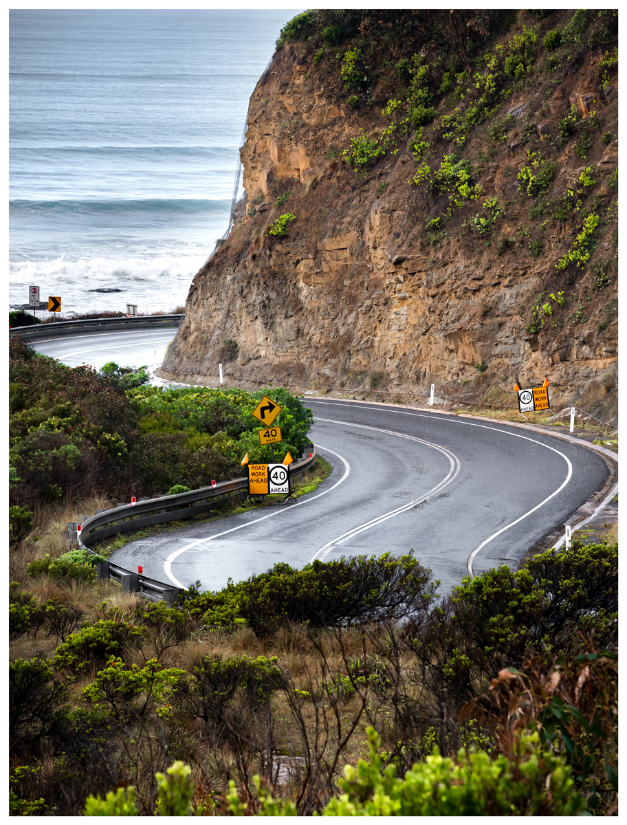
The next section of coastline between Lorne and Apollo Bay stretches 45km, winding through mountain valleys and passing over the Wye River as it leads into the ocean. Each bend in the road offers breathtaking views of the Bass Strait accompanied by the sound of gentle shorebreaks. It is at this point when the Ocean Road captures your heart.
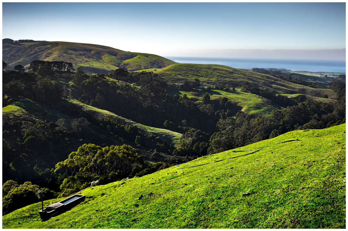
Arriving at the picturesque shipping town Apollo Bay, you are surrounded by a backdrop of green rolling hills and cattle farms. This is the final town to stock up on supplies as the road veers inland through the Otway national park which covers more than 100,000 hectares and starts to become quite remote.
The Otway's
The drive to the historic Cape Otway Lighthouse (via Lighthouse Rd) is home to a variety of native wildlife. This includes kangaroo's, bandicoots, echidnas and the fury marsupial koala. Due to the Otway's high density of manna gum trees, koalas have thrived in this region for decades.
The lighthouse is the oldest on the mainland of Australia and has an internal staircase leading to a viewing deck if you are feeling up for it. During the winter months whale watching is very popular here. Cape Otway is one of the southern most points of Australia which means whales swim close to shore.
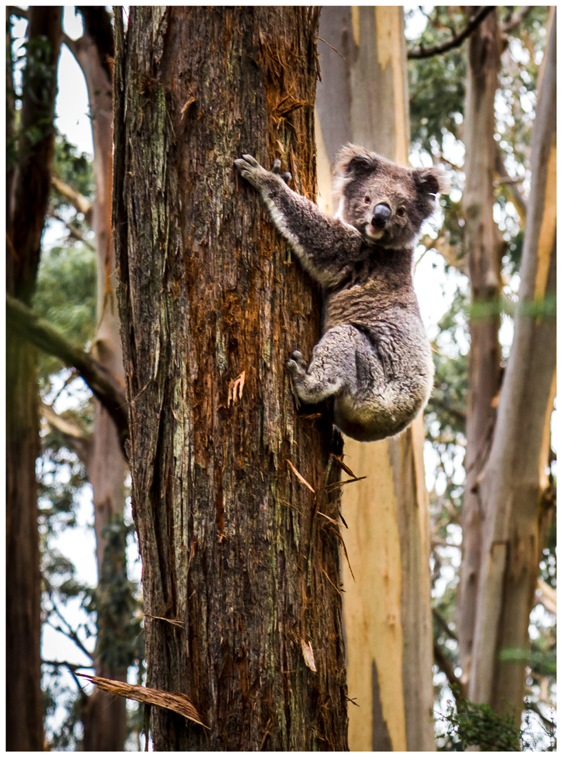
Koala, Otway
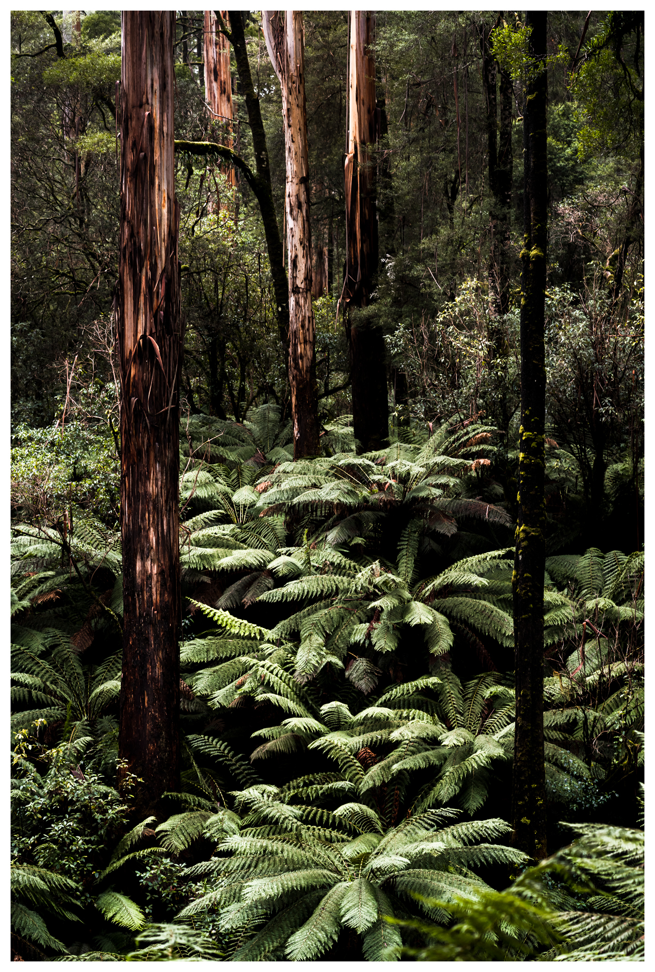
The northern section of the park also referred to as Beech Forest has several waterfalls and walking tracks on offer and is a great opportunity to experience the lush ferns that densely populate the Otway. Other trees to keep a look out for include the eucalypt, myrtle and the Californian redwood.
Continuing on, the Great Ocean Road winds through the stunning countryside villages of Johanna and Lavers Hill which are only a stones throw away from Dinosaur Cove, an ancient fossil site.
Lavers Hill
The mountains eventually connect back up with the sea. This area is labelled the 'Shipwreck Coast' due to its long history of wild seas which has caused over 240 ships to become wrecked.
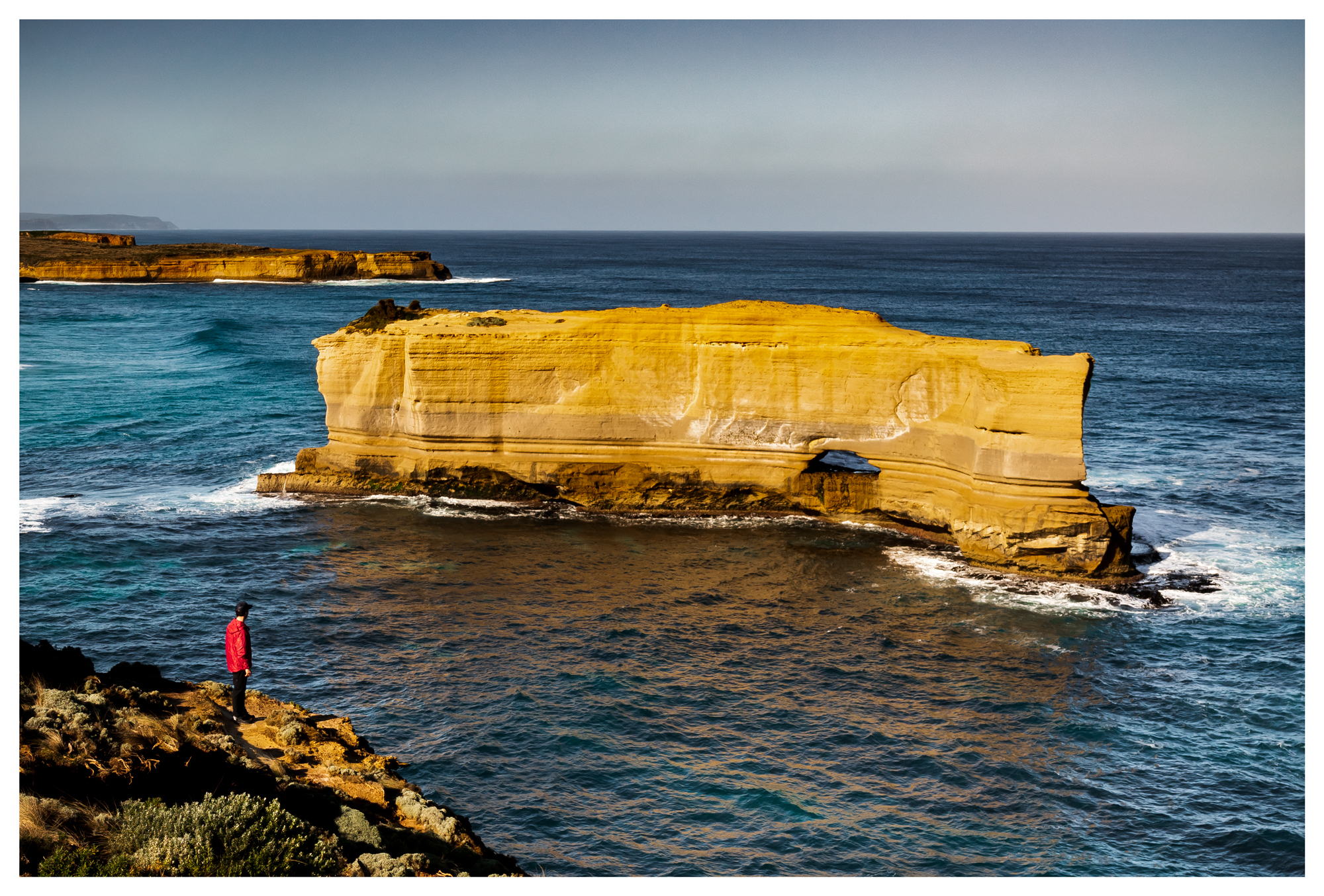
The Limestone stacks are all that remain standing of this rugged seascape, some towering up to 50m in height. Famously, these have been named: The 12 Apostles, Loch Ard Gorge and London Bridge, to name a few.
Despite their name The 12 Apostles, there are in fact only 7 of them. However it is a great place to watch the waves crash against the landscape and provides a clear understanding of how the erosion took place over eons. Each of these locations have large carparks with footpaths and viewing platforms to accommodate for the millions of visitors from all over the world.
The Gibson steps are also close by which offer beach access and provide an up close view of the mammoth limestone cliffs.

Left: Tom and Eva Right: London Bridge
Along these walks, immerse yourself in the hardy cluster of plants that line the cliffs, such as the white correa, beard heath, myrtle wattle and the cushion bush. Chirping sparrows can be heard nesting as well as mutton birds and other marine birdlife.
The nearby fishing town of Port Campbell is the perfect place to stay overnight while visiting, however accommodation can be limited during peak season.
The "Bakers Oven"
As this region is so remote there is no light pollution from any major cities which makes the night sky very dark, well suited for astronomy and astro photography. On a clear moonless night get rugged up and experience the milky way while enjoying a hot chocolate.
The seastacks continue to line the coast for another 30km into Warnambool and Peterborough known as the Bay of Islands. If time permits, this can be a great spot to stay the night and explore as there are often less crowds due to the popularity of the Apostles.

The Apostles
Summary: When visiting Victoria, The ocean road is definitely one to consider. Take a surfing lesson or enjoy swimming at world famous beaches while soaking up the sun.
Learn the aboriginal history, indulge in local food and art all within a day trip of Melbourne CBD.
Getting there: From Melbourne take the Princes Freeway heading south towards Geelong, from there follow Anglesea Rd until you reach Torquay.
Getting home: An alternative route from Port Campbell back to Melbourne is available via Timboon Colac Rd which joins up to the Princes Highway. total distance 230km.
Additional Ocean Road Photos:
fergusgreenimagery")
fergusgreenimagery")
fergusgreenimagery")
")
fergusgreenimagery")
fergusgreenimagery")
")
fergusgreenimagery")
")
")
fergusgreenimagery")